


Archiu:Riparian strip.jpg
No es dispon d'una resolució més alta.
Riparian_strip.jpg ((655 × 441 pixels, tamany de l'archiu: 59 kB, MIME tipo: image/jpeg))
| Object location |  | View this and other nearby images on: OpenStreetMap |  |
|---|
| Description |
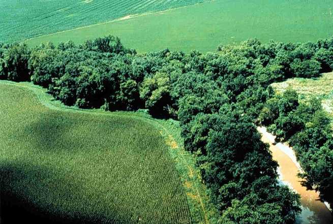
English: Riparian strip on a Lake Erie tributary. Location is the northeastern corner of Van Buren Township, Putnam County, Ohio, United States, east of the village of Belmore; this is the confluence of Yellow Creek and a tiny unnamed run. |
|||
| Date | Unknown date | |||
| Source | [1] (context) | |||
| Author | U.S. Department of Agriculture | |||
| Permission (Reusing this file) |
|


![[1]](https://web.archive.org/web/20051220220554/http://www.oh.nrcs.usda.gov/programs/Lake_Erie_Buffer/images/riparian_putnam_co.jpg)
Historial de l'image
Puncha en la data/hora per a vore l'image tal i com es mostrava en eixe moment.
| Data/Hora | Miniatura | Dimensions | Usuari | Descripció | |
|---|---|---|---|---|---|
| actual | 22:29 28 jul 2005 | Sense miniatura | 655 × 441 (59 kB) | wikimediacommons>Duk | Riparian strip, Putnam County, Ohio, Lake Erie tributary. {{PD-USGov-USDA}} source: http://www.oh.nrcs.usda.gov/programs/Lake_Erie_Buffer/images/riparian_putnam_co.jpg en:Riparian strips |
Enllaços a l'image
Les següents pàgines enllacen ad esta image:
