


Archiu:Thatcher-Peninsula.jpg
Tamany d'esta vista prèvia: 800 × 600 píxels. Atres/s resolucions: 320 × 240 píxels | 640 × 480 píxels | 1000 × 750 píxels.
Resolució completa. ((1000 × 750 pixels, tamany de l'archiu: 660 kB, MIME tipo: image/jpeg))
Summary
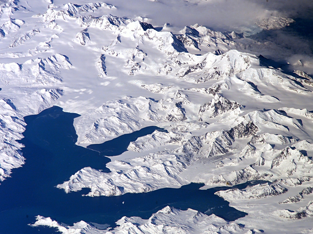
English: Satellite image of central South Georgia Island - in the Antarctic region.
- View of Cumberland Bay - with Thatcher Peninsula and King Edward Cove (Grytviken); and the Allardyce Range with the summit Mt. Paget.
- Credits
- Image Science and Analysis Laboratory, NASA-Johnson Space Center. 25 Mar. 2005. "Astronaut Photography of Earth - Display Record."[1]
- Source
- URL

|
This image or video was catalogued by one of the centers of the United States National Aeronautics and Space Administration (NASA) under Photo ID: ISS011-E-12148. This tag does not indicate the copyright status of the attached work. A normal copyright tag is still required. See Commons:Licensing. Other languages:
|


Licensing

|
This file is in the public domain in the United States because it was solely created by NASA. NASA copyright policy states that "NASA material is not protected by copyright unless noted". (See Template:PD-USGov, NASA copyright policy page or JPL Image Use Policy.) |  |
 |
Warnings:
|

Historial de l'image
Puncha en la data/hora per a vore l'image tal i com es mostrava en eixe moment.
| Data/Hora | Miniatura | Dimensions | Usuari | Descripció | |
|---|---|---|---|---|---|
| actual | 09:26 1 oct 2007 | | 1000 × 750 (660 kB) | wikimediacommons>Apcbg | Satellite image of central South Georgia Island: Cumberland Bay; Thatcher Peninsula with King Edward Cove (Grytviken); Allardyce Range with the summit Mt. Paget. Image Science and Analysis Laboratory, NASA-Johnson Space Center. 25 Mar. 2005. "Astronaut P |
Enllaços a l'image
Les següents pàgines enllacen ad esta image:
