


Archiu:Satellite image of Antigua And Barbuda in September 2002.jpg
No es dispon d'una resolució més alta.
Satellite_image_of_Antigua_And_Barbuda_in_September_2002.jpg ((311 × 372 pixels, tamany de l'archiu: 16 kB, MIME tipo: image/jpeg))

Summary
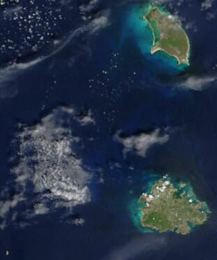
| Description | Cropped satellite image, showing the three islands of Antigua And Barbuda. |
| Date | |
| Source | Cropped from: http://visibleearth.nasa.gov/view_rec.php?id=4342 |
| Author | Jacques Descloitres, MODIS Rapid Response Team, NASA/GSFC |
Licensing

|
This file is in the public domain in the United States because it was solely created by NASA. NASA copyright policy states that "NASA material is not protected by copyright unless noted". (See Template:PD-USGov, NASA copyright policy page or JPL Image Use Policy.) |  |
 |
Warnings:
|

| Annotations | This image is annotated: View the annotations at Commons |
Historial de l'image
Puncha en la data/hora per a vore l'image tal i com es mostrava en eixe moment.
| Data/Hora | Miniatura | Dimensions | Usuari | Descripció | |
|---|---|---|---|---|---|
| actual | 14:26 18 dec 2004 | | 311 × 372 (16 kB) | wikimediacommons>Hautala | {{PD-USGov-NASA}} Cropped satellite image, showing the three islands of Antigua And Barbuda. Original image taken from NASA's Visible Earth http://visibleearth.nasa.gov/cgi-bin/viewrecord?21888 |
Enllaços a l'image
Les següents pàgines enllacen ad esta image:
